
Zoom Earth
- Weather
- 3.1
- 28.5 MB
- by Neave Interactive
- Android 8.0+
- Jan 11,2025
- Package Name: com.neave.zoomearth
Monitor hurricanes, typhoons, and tropical cyclones globally with real-time data.
Zoom Earth provides an interactive world weather map and real-time hurricane tracker. Its features include satellite imagery, rain radar, weather forecast maps, hurricane and wildfire tracking, and extensive customization options.
Key Features:
-
Satellite Imagery: Access near real-time satellite imagery from NOAA GOES, JMA Himawari, EUMETSAT Meteosat, and NASA's Aqua and Terra satellites.
-
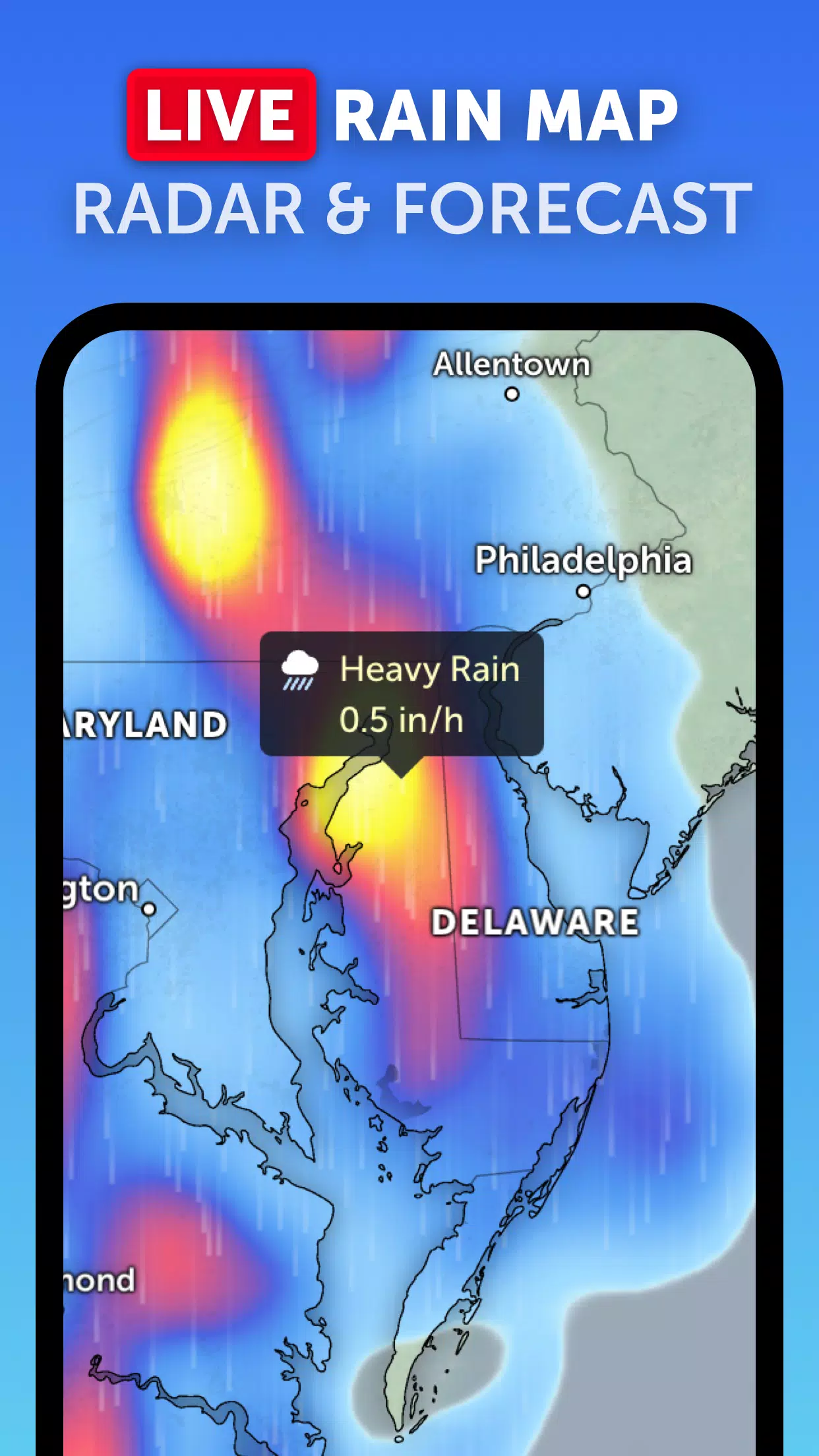
Rain Radar: View real-time rain and snow detection from ground-based Doppler radar.
-
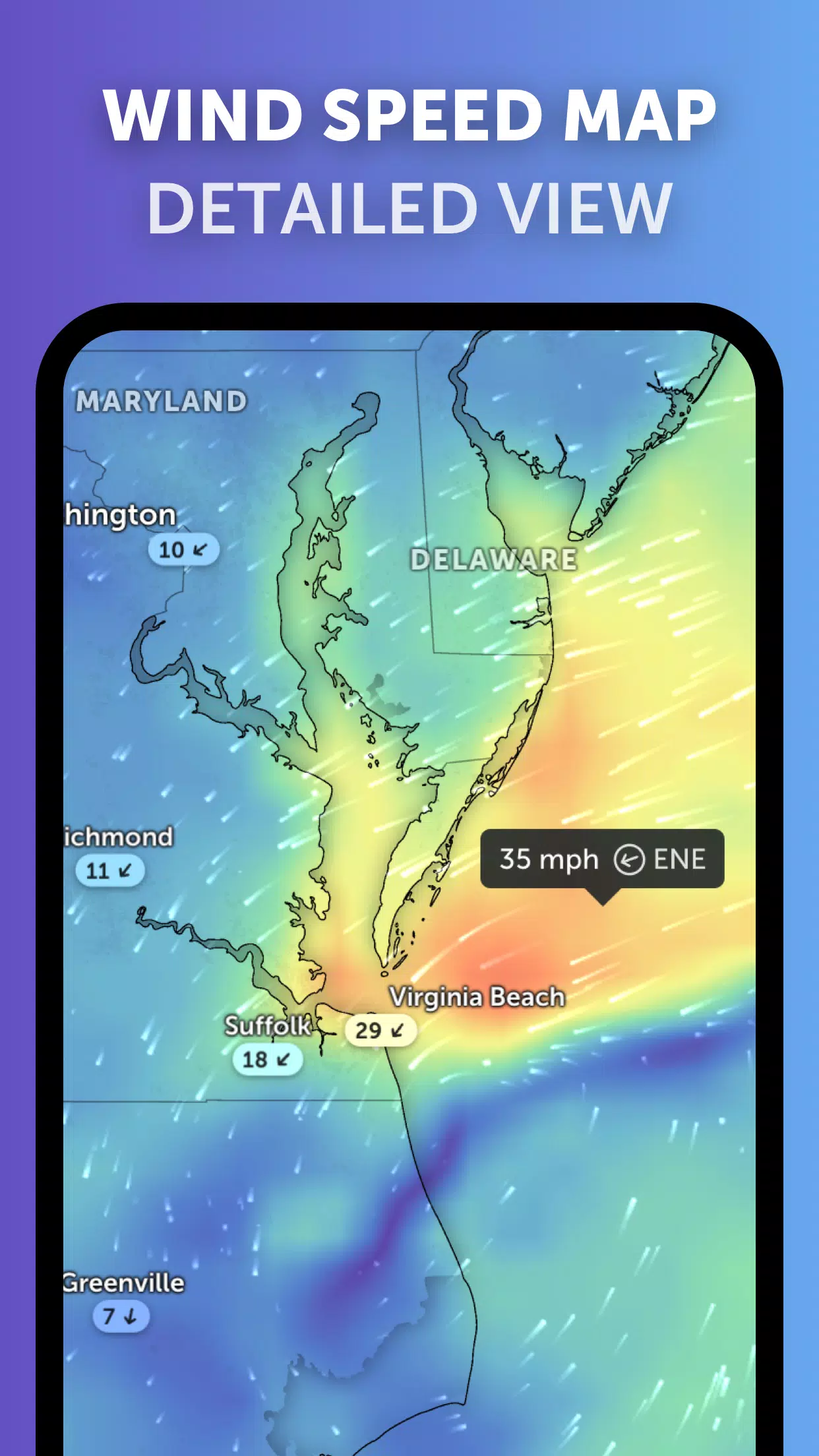
Weather Forecast Maps: Explore interactive weather visualizations, including precipitation, wind speed and gusts, temperature, "feels like" temperature, humidity, dew point, and atmospheric pressure.
-
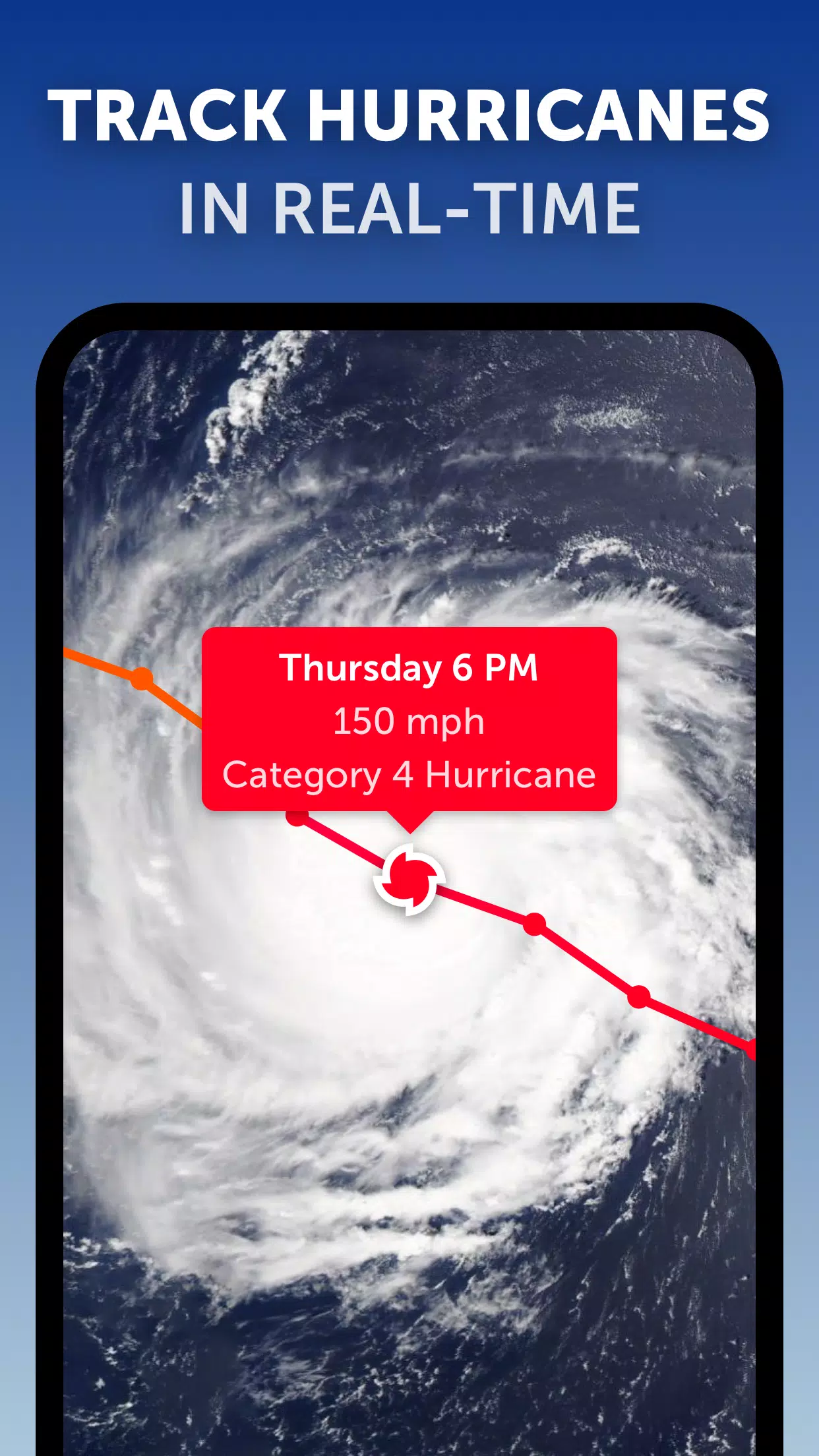
Hurricane Tracking: Track hurricanes, from formation to Category 5, using data from NHC, JTWC, NRL, and IBTrACS.
-
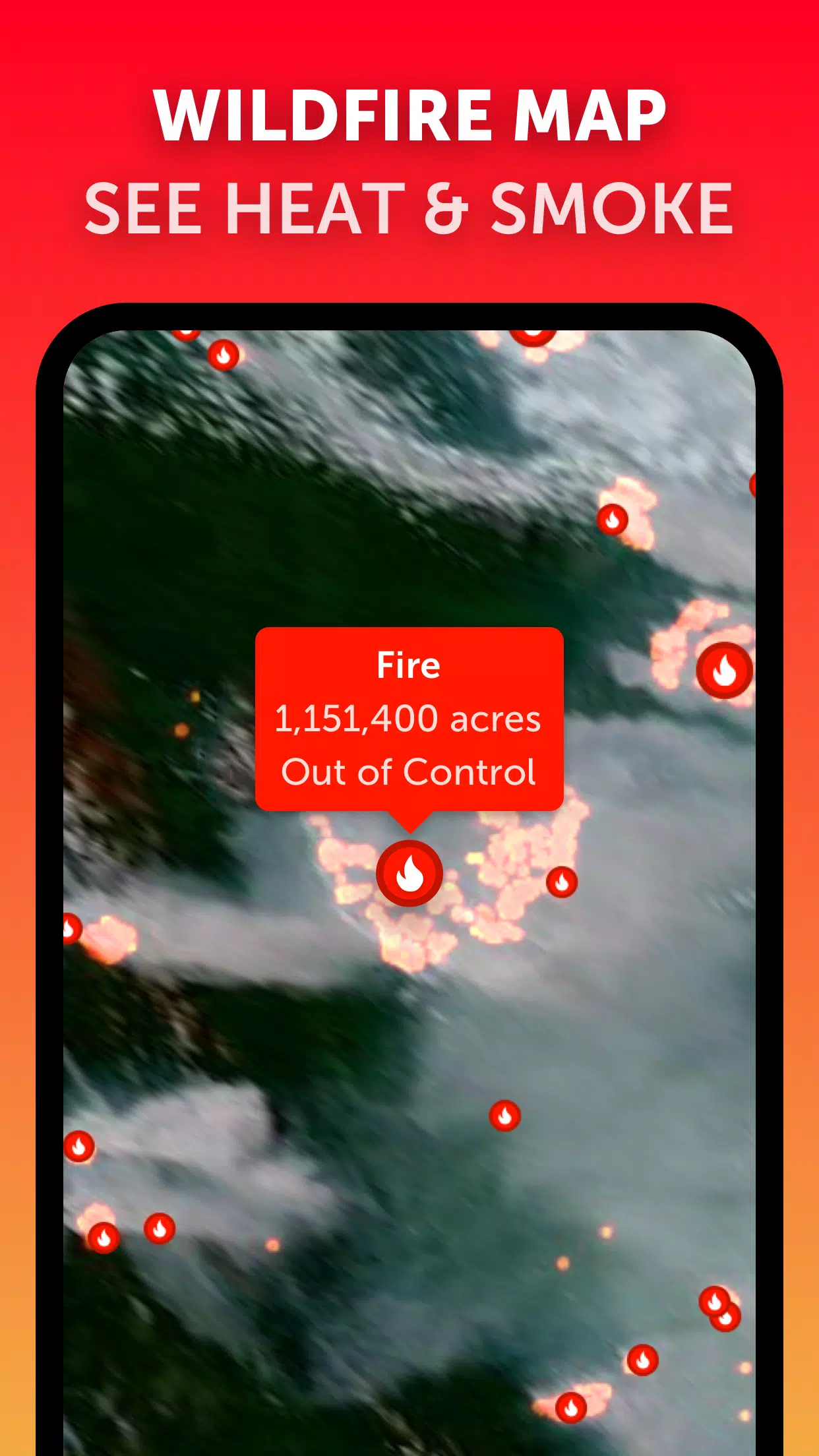
Wildfire Tracking: Monitor active wildfires and heat spots using daily updates from NASA FIRMS satellite data.
-
Customization: Personalize your experience by adjusting temperature and wind units, time zone, animation styles, and more.
Version 3.1 Updates (September 19, 2024)
- Improved clarity when viewing multiple tropical weather systems.
- Separate alerts for Atlantic and Eastern Pacific storms.
- Enhanced map labeling.


-
 ICE on the Edge: Anime Figure Skating Simulator
Melpot Studio has released the debut trailer for its upcoming figure skating simulator, ICE on the Edge, scheduled for a PC launch on Steam in 2026. This ambitious project aims to blend striking anime-style art with precise, authentic skating routine
May 11,2026 -
Helldivers 2 Gamers Rally After Mars Attack
A full-scale assault on Super Earth is now raging in Helldivers 2's latest update, bringing the warfront terrifyingly close to humanity's doorstep. Amidst the planetary turmoil, commanders have confirmed devastating news - the Illuminate have obliter
May 10,2026 - ◇ Wild Rift 6.2 Update Arrives with New Theme May 10,2026
- ◇ UNO Mobile Partners with Snoopy & Peanuts for Summer Fest May 08,2026
- ◇ Elden Ring Classes Ranked Worst to Best May 08,2026
- ◇ Kelarr's Might & Magic: Olden Era Creations Revealed May 06,2026
- ◇ "Alcyone: The Last City Launches on iOS, Android with Tough Choices" May 06,2026
- ◇ EA FC Mobile NEON Event: Rewards & Challenges May 04,2026
- ◇ Final Fantasy IX 25th Anniversary Hype Fuels Remake Demand May 04,2026
- ◇ Metro Quester: Kemco Unveils Gritty Dungeon-Crawling RPG May 03,2026
- ◇ Solo Leveling: Arise Adds New Story Chapters, SSR Hunter May 01,2026
- ◇ "Leader's Design in Captain America: Brave New World Unveiled, Echoes Comic Book Origins" May 01,2026


- 1 Roblox Game Codes Updated: April 2025 May 13,2025
- 2 The Best Gaming PC of 2025: Top Prebuilt Desktops Mar 26,2025
- 3 Roblox: Warrior Cats: Ultimate Edition Codes (January 2025) Feb 12,2025
- 4 Idle Heroes Team Compositions – January 2025 Mar 16,2025
- 5 Tips to Conquer the Dragon Quest III: HD-2D Remake Feb 21,2025
- 6 Pokémon GO Fest 2025: Fest Dates, Locations, Details Revealed Feb 13,2025
- 7 Pokémon Go Is Celebrating New Year’s 2025 with Festive Fireworks and More! Jan 03,2025
- 8 Fortnite: Chapter 6 Season 1 NPC Locations Feb 13,2025


-
Unique Wallpaper Apps for Every Style
A total of 10
-
Top Beauty Trends for This Season
A total of 10
-
Ultimate Baseball Games for Android
A total of 10